Colortrac SmartLF large format scanning solutions help WV achieve milestone
Colortrac today announces that the West Virginia State GIS Tech Center has scanned more than 300,000 documents for its geographic information system (GIS) database of state maps. This also represents the majority of the GIS Tech Center’s archive, which is now available online. The scanned archive is valuable to users of GIS, digital mapping, and remote sensing within the State of West Virginia.
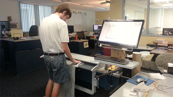
To achieve this milestone, the team at the GIS Tech Center uses two Colortrac SmartLF 42-inch large format scanning solutions. The SmartLF scanners are ideal for capturing sharply defined detail on technical drawings and maps, as well as vibrant colors. Staffers use Colortrac’s SmartWorks Pro software to manage the scanning steps and to automatically number and name the plans.
The GIS Tech Center’s digital archive includes projects ranging from floodplain mapping to updates for the National Hydrography Dataset. The Center also facilitates GIS web map applications for the State Historic Preservation Office, West Virginia Trail Inventory, and others.
Since purchasing the Colortrac large format scanners in 2015, the GIS Center has captured more than 300,000 documents. Nearly 10,000 plan sets are available in multiple databases on the Plans Locator website.
“The Colortrac scanners significantly increased our throughput, reducing the cost per sheet scanned. This is important given the vast number of documents that we scan. In addition to throughput, the Colortrac scanners are proving to be durable,” notes Eric Hopkins, Lead GIS Specialist at the Center.
www.colortrac.com